Best Estes Park Hikes: Black Lake, Chasm Falls, Tundra Communities Trail.
June 23, 2021

The hike to Black Lake is well worth the journey; hikers will pass multiple beautiful lakes and waterfalls on their way including Alberta Falls and Mills Lake. Also providing some of the most gorgeous and unobstructed views of the beautiful Rocky Mountains including McHenry’s Peak and Chiefs-Head Peak. While the views are second to none in the park, the nearly five mile hike to Black Lake is steep to say the least and requires a strong sense of direction. Multiple junctions require that hikers know when and where they must turn in order to actually reach the lake. That being said, experienced hikers would be hard-pressed to find a hike with as much to see as this so close to Estes Park.
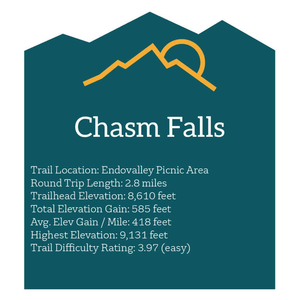
An easy and accessible hike, the trip to chasm falls provides a unique and limited time experience located just west of Estes Park. Visitors can hike at the Endovalley Picnic Area and must simply follow Old Fall River Road for just over a mile. Following this road will lead hikers directly to the Chasm Falls Trailhead where a viewing platform is set up to witness one of the park’s most awe-inspiring waterfalls. While the hike is not especially demanding, Old Fall River Road is not open year round and guests are encouraged to look on the RMNP website to confirm that access is available. That being said, if Chasm Falls can be reached the granite waterfall is imposingly beautiful. A mixture of power and serenity make this a popular and well-worthwhile sojourn. 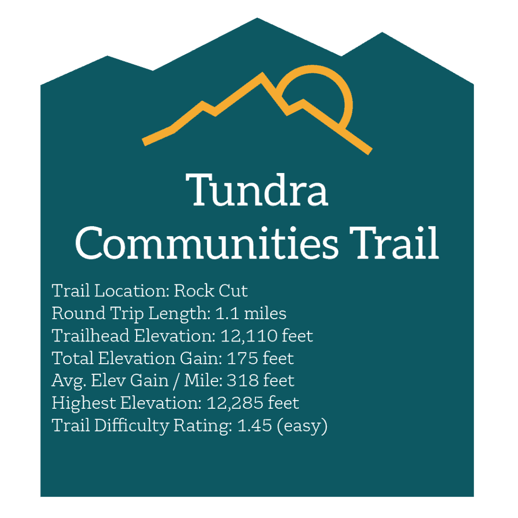 The Tundra Communities Trail is one of the most lasting trails in the entirety of Rocky Mountain National Park. Originally believed to be used by Ute Native Americans to travel across the tundra, the lasting wide-open views and breathtaking landscape make it clear why. Resting above the timberline, a wide swath of mountains and gorgeous tundra expand out as far as the eye can see. Existing this high up, the tundra is a perpetually frosty area and hikers are highly encouraged to bundle up, even in the dead of summer. Along this trail hikers may be lucky enough to spot one of the park’s most famous animals: the pika. Astounding rock formations known as the Mushroom Rocks can also be found along the trail. At the peak, one can be met with views of Longs Peak, Mummy Mountain, and many other sights.
Elevated Avocado Toast
Our toasted, thick cut whole-grain toast topped with fresh mashed avocado, grilled and seasoned crab meat topped with pesto tomatoes, extra-virgin olive oil, sea salt, and fresh herbs. Served with lemon wedge and two eggs cooked fresh to order.
Summer Berry Waffle Combo
A golden Belgian waffle topped with strawberries, blueberries and bananas, with sprinkled powdered sugar and whipped cream. Served with two eggs cooked to order and your choice of two strips of pecan wood smoked bacon or sausage patties.
Breakfast Carnitas Tacos
Three breakfast tacos, served on corn tortillas, filled with scrambled eggs, shredded smoked pork, topped with fresh Pico De Gallo and Avocado sauce. Dish is served with Ranch Potatoes.